- $10.2 billion: The global Assured PNT market is projected to reach this value by 2035, up from $846 million in 2025. - 2,400x stronger signals: Iridium's LEO satellites provide signals up to 2,400 times stronger than traditional GPS, making them far harder to jam. - 54% CAGR: The LEO PNT market is expected to grow at a compound annual growth rate of nearly 54% through 2030.
Experts agree that VIAVI's IRINS represents a critical advancement in resilient navigation technology, offering a robust solution to the growing threats of GPS jamming and spoofing in both military and civilian applications.
VIAVI's New System Fights GPS Jamming with LEO Satellite Power
CHANDLER, Ariz. – January 29, 2026 – Inertial Labs, a company under the umbrella of test and measurement giant VIAVI Solutions, today unveiled a new navigation system designed to operate in the most challenging electronic warfare environments. The system, called IRINS, provides a robust alternative to GPS, which is increasingly vulnerable to jamming and spoofing attacks that threaten military operations and critical civilian infrastructure.
The Growing Shadow War on Navigation
The global reliance on the Global Navigation Satellite System (GNSS), most commonly known as GPS, has created a critical vulnerability. In recent years, a quiet but escalating electronic war has seen a dramatic rise in jamming and spoofing incidents. These attacks, which can either block satellite signals entirely or feed false location and time data to receivers, are no longer the exclusive domain of nation-states. Low-cost jammers, available for a few hundred dollars, can disrupt signals over a 30-kilometer radius, making them an accessible tool for a wide range of actors.
The consequences are severe. For military forces, a disrupted GPS signal can mean the difference between mission success and catastrophic failure, affecting the navigation of troops, drones, and precision-guided munitions. Recent conflicts have provided stark evidence of these vulnerabilities, with spoofing leading to misdirected movements in active war zones.
The threat extends far beyond the battlefield. Modern society's foundational systems—telecommunications, power grids, financial markets, and emergency services—all depend on the precise timing and location data provided by GNSS. A report commissioned by the UK Space Agency estimated a five-day loss of GNSS could cost its economy over £5 billion. In the United States, a prolonged outage could translate to daily economic losses exceeding $1 billion. This has created an urgent demand for what the industry calls Assured Positioning, Navigation, and Timing (APNT) solutions.
A Multi-Layered Defense Against Disruption
In response to this growing threat, Inertial Labs has launched IRINS, a Low Earth Orbit (LEO)-aided inertial navigation system (INS). The system is engineered to provide continuous, trustworthy PNT data even when GPS signals are denied, degraded, or deliberately disrupted—a condition the military refers to as D3SOE (Denied, Degraded, and Disrupted Space Operating Environments).
The IRINS platform is not a single technology but a tightly integrated fusion of three core components. It includes a tactical-grade INS, which uses internal accelerometers and gyroscopes to calculate position through dead reckoning, an Altitude and Heading Reference System (AHRS) for precise orientation, and a LEO PNT receiver. This multi-layered approach ensures that if one system is compromised, others can maintain navigational integrity.
"The IRINS is the first fruit borne of VIAVI's visionary strategy to mitigate vulnerabilities in positioning, navigation, and timing, bringing together resilient satellite-based timing with tactical-grade IMUs to deliver the most precise PNT for GNSS-denied environments," said Jamie Marraccini, Vice President of Inertial Labs Products at VIAVI. "By tightly coupling inertial sensing, LEO-based timing and navigation and anti-jam GNSS technologies into a single platform, the IRINS provides unmatched continuity, accuracy and trust for operations in contested and denied environments."
A key element of this resilience is the system's link to the Iridium LEO satellite constellation. Unlike traditional GPS satellites in medium Earth orbit, Iridium's LEO satellites orbit much closer to the planet, resulting in signals that are up to 2,400 times stronger. This immense power advantage makes the signals significantly harder to jam and allows them to be received in locations where GPS fails, such as indoors or in dense urban canyons.
The Strategic Race for Assured PNT
The launch of IRINS highlights a significant strategic shift within the technology and defense sectors. As GPS vulnerabilities become more apparent, a new market for resilient PNT solutions is booming. Forecasts project the global Assured PNT market to skyrocket from an estimated $846 million in 2025 to over $10.2 billion by 2035. The LEO PNT market, a key segment of this growth, is expected to expand at a compound annual growth rate of nearly 54% through 2030.
VIAVI's entry is a calculated move, building on strategic acquisitions of specialists like Inertial Labs for inertial systems and Jackson Labs for timing expertise. This positions the company to offer a comprehensive, single-vendor solution in a highly competitive field. Other major defense and technology firms, such as Safran and BAE Systems, are also racing to develop their own APNT technologies, integrating advanced inertial sensors, atomic clocks, and alternative satellite signals to create robust navigation systems.
The collaboration with Iridium is a critical piece of this strategy. The Iridium network provides a globally available, GNSS-independent signal for time and location, offering a true backup when primary systems are attacked.
"Assured access to PNT is critical for operations in contested environments," stated Maynard Porter, Director of Government PNT Business at Iridium. "Integrating Iridium PNT alongside VIAVI's INS and AHRS provides users with an exceptionally resilient source of time and location data to maintain operational effectiveness when GNSS signals are disrupted."
Built for the Harshest Environments
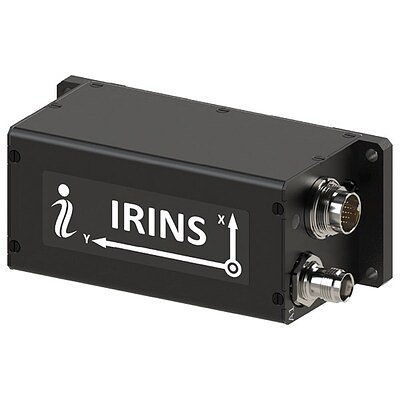
To be effective, a resilient navigation system must be able to survive the physical rigors of deployment. The IRINS unit is housed in a compact enclosure (126.5 × 49.3 × 53.3 mm) and is certified to meet stringent military and industrial standards. Its IP67 rating ensures it is completely dust-tight and can be temporarily submerged in water, while its MIL-STD-810G certification guarantees its ability to withstand extreme temperatures, shock, vibration, and humidity.
These specifications make it suitable for a vast array of applications. For the military, it can be integrated into unmanned aerial vehicles (UAVs), loitering munitions, tactical ground vehicles, and naval vessels, ensuring they can navigate and operate effectively in the face of enemy electronic warfare. Beyond defense, the technology has profound implications for critical infrastructure. It can provide the ultra-reliable timing required for 5G telecommunication networks and energy grids, secure maritime navigation for commercial shipping, and enable the safe operation of autonomous vehicles and drones in complex urban environments where GPS signals are often unreliable. The system's integration of a GNSS receiver with a port for a Controlled Reception Pattern Antenna (CRPA) further enhances its defenses, allowing it to actively detect and filter out jamming and spoofing signals.
Topics & Related
Cryptocurrency & Digital Assets
AI & Machine Learning
Aerospace & Defense
Fintech
Geopolitical Risk
Generative AI
Artificial Intelligence
Growth Equity
CAGR
EBITDA
Related Company Pulse