- 130 million people live in areas affected by radar gaps
- 29 radars installed by Climavision in storm-prone states
- 30+ NWS offices to gain access after pilot expansion
Experts agree that integrating private-sector radar technology with NWS systems significantly enhances severe weather prediction accuracy and public safety by closing critical coverage gaps.
NWS Closes Critical Radar Gaps with Private Tech Integration
LOUISVILLE, Ky. – January 07, 2026 – National Weather Service (NWS) forecasters responsible for issuing life-saving warnings now have a powerful new tool in their arsenal, one that allows them to see into dangerous weather blind spots that have long hampered prediction efforts. In a landmark public-private partnership, weather technology firm Climavision has integrated its proprietary radar network directly into the NWS's mission-critical software, promising to enhance the accuracy and speed of alerts for millions of Americans.
This integration embeds high-resolution commercial radar data into the Advanced Weather Interactive Processing System (AWIPS II), the sophisticated software platform that serves as the operational backbone for NWS meteorologists nationwide. For the first time, forecasters can view Climavision's supplemental radar imagery seamlessly alongside the government's own NEXRAD radar data, satellites, and other observations within a single, unified environment. This streamlined access is designed to improve forecaster confidence and efficiency during high-impact events like tornado outbreaks and severe thunderstorms.
Closing Critical Blind Spots
The core of the problem this partnership aims to solve is the existence of significant 'radar gaps' across the United States. Due to the curvature of the Earth, terrain blockages, and sheer distance from radar sites, the government's NEXRAD system cannot always see what is happening in the lower levels of the atmosphere. It is in this critical zone, often just a few thousand feet off the ground, where some of the most dangerous weather, including tornadoes, first begins to form.
According to Climavision, these gaps in low-level coverage affect areas where nearly 130 million people live. “Every gap in coverage represents a community at risk,” said Chris Goode, Co-Founder and CEO of Climavision, in a statement. “Our mission is to close those gaps and give NWS forecasters improved access so they can use it for the mission they fulfill so well – saving lives.”
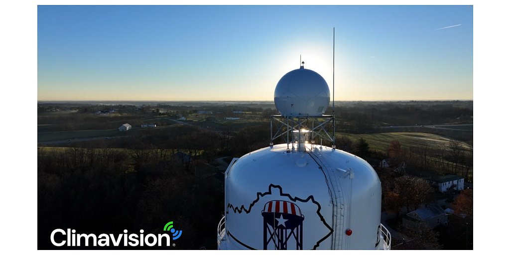
To address this, the Louisville-based company has been strategically building its own network of high-resolution radars since 2021. With 29 radars now installed in storm-prone states like Texas, Oklahoma, and Georgia, the network is specifically engineered to provide detailed observations in the very lower-atmospheric blind spots that federal systems miss. While NWS forecasters have had some access to this data since 2023, it required using separate, third-party tools, creating an inefficient workflow during time-sensitive weather events. The direct AWIPS integration marks a major operational milestone, putting vital data directly at forecasters' fingertips when seconds count.
A New Model for Government Innovation
This initiative is a prime example of a growing trend where federal agencies leverage commercial innovation to enhance public services. The complex integration was made possible through a multi-company collaboration under the umbrella of NOAA’s National Mesonet Program (NMP), a program designed specifically to procure data from non-federal observing networks.
KBR, a global science and technology firm, serves as the prime contractor for the NMP. Working with its lead subcontractor, Synoptic Data PBC, KBR delivers meteorological data from a vast 'network of networks' comprising over 50,000 private and public observing platforms. It was KBR's TOWR-S group that handled the technical work of integrating Climavision's data feed into the AWIPS system.
“In a rapidly evolving world, it’s critical for government agencies to leverage the power of commercial innovation and agility,” noted Ellen Cousins, KBR’s NMP program manager. This sentiment underscores a strategic shift towards a more flexible and collaborative approach to sourcing critical environmental data.
Synoptic Data, a public benefit corporation, plays the crucial role of a data aggregator, facilitating the flow of information from diverse sources to end-users like the NWS. “Our goal at Synoptic is to get data into the hands of those who need it the most,” said Elizabeth Wilson, Director of Weather Programs at Synoptic. “Facilitating data access to Climavision’s network for the NWS to keep communities safe is exactly what our mission, and the NMP, are all about.”
Beyond NEXRAD: The Future of Weather Prediction
The integration also signals a broader evolution in the nation's weather observation strategy. The NEXRAD system, while a cornerstone of U.S. weather forecasting for decades, is an aging infrastructure. This partnership highlights how supplemental commercial networks can augment and enhance government capabilities without requiring a complete overhaul of existing systems.
Research has consistently shown that providing forecasters with higher-resolution, more frequently updated radar data can lead to tangible improvements in warning performance. Studies on similar rapid-scan technologies have demonstrated the potential for increased tornado warning lead times and a reduction in false alarms, boosting public trust and responsiveness.
This project aligns with NOAA's wider Commercial Data Program, which actively explores purchasing 'data-as-a-service' from the private sector to improve forecasts. This model is being explored for various data types, from satellite observations to the ground-based radar data provided by Climavision. The move is so significant that a proposed Radar Program Office within the government is tasked with studying the future of the nation's radar capabilities, including the option of purchasing commercial data as a service.
The integration is currently launching as a pilot program at select NWS Weather Forecast Offices. Following a successful evaluation period over the next few months, access is planned to be expanded to more than 30 offices, bringing this enhanced capability to a much wider swath of the country. This public-private partnership will continue to expand as Climavision builds out its network and extends its relationship with the federal government to enhance severe weather preparedness nationwide.