- 90,000 registered users of NAV Drone app, with a third joining in the last year
- 150 kg maximum drone weight now supported for commercial operations
- BVLOS flights enabled in uncontrolled airspace, expanding operational range
Experts agree that the NAV Drone app update, combined with Transport Canada’s regulatory framework, is a pivotal step in unlocking Canada’s commercial drone potential, fostering innovation and economic growth across key industries.
Canada's Drone Ecosystem Takes Flight: NAV CANADA Update Unlocks New Commercial Potential
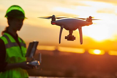
OTTAWA, ON – Canada is poised to see a significant expansion in drone-based commercial activity following a major update to NAV CANADA’s NAV Drone app. Launched this week alongside the second phase of Transport Canada’s 2025 drone regulations, the update unlocks new operational capabilities, from beyond visual line-of-sight (BVLOS) flights to support for medium-weight drones, promising a surge in innovation and economic opportunity.
For years, regulatory hurdles have constrained the widespread adoption of drone technology beyond recreational use. The NAV Drone app, initially launched in 2021, has served as a crucial bridge, facilitating safe access to controlled airspace. However, the latest enhancements represent a pivotal step forward, addressing key limitations and aligning with evolving industry needs.
“This isn’t just about keeping pace with regulations; it's about unlocking the full economic potential of Canada’s skies,” explains David Sheppard, Vice President and Chief Technology and Information Officer at NAV CANADA. “By enabling more complex and commercially relevant drone operations, we are supporting Canadian businesses, creating jobs, and strengthening our position in the global drone economy.”
Beyond Visual Line of Sight and Expanding Capabilities
The update allows for low-risk BVLOS flights in uncontrolled airspace, a game-changer for industries requiring broader area coverage. Previously, stringent visual line-of-sight requirements limited operational range and efficiency. Now, with appropriate safety protocols and certified visual observers, drones can inspect pipelines, monitor remote infrastructure, and conduct large-scale agricultural surveys with greater ease.
“The BVLOS capability is transformative,” says an industry analyst specializing in drone technology. “It opens up possibilities for applications we previously only dreamed of, like long-range delivery services and comprehensive environmental monitoring.”
Beyond BVLOS, the app now supports drones weighing up to 150 kilograms – a crucial development for industries requiring heavier payloads. This unlocks opportunities in precision agriculture – where drones can carry sophisticated sensors and deliver targeted treatments – and infrastructure inspection, where heavier drones can carry high-resolution cameras and LiDAR systems.
A Regulatory Framework Aligned with Innovation
The update is inextricably linked to Transport Canada’s phased regulatory roadmap for remotely piloted aircraft systems (RPAS). The second phase of these regulations, now in effect, aims to foster safe integration while allowing for more complex operations. NAV CANADA has worked closely with Transport Canada to ensure the app aligns perfectly with these new rules.
“The alignment between NAV Drone and the Transport Canada regulations is seamless,” notes a consultant working with several drone operators. “This makes compliance much easier and reduces the administrative burden for businesses.”
The app now facilitates sheltered operations – flights close to structures – with appropriate safety protocols and extended visual line-of-sight (EVLOS) operations supported by certified visual observers, adding further flexibility for various applications.
Impact on Key Industries
The implications of this update extend across multiple sectors. Agriculture stands to benefit significantly. Farmers can now utilize drones for precision spraying, crop health monitoring, and yield optimization, leading to increased efficiency and reduced costs.
Infrastructure inspection will also be revolutionized. Drones can now inspect bridges, power lines, and pipelines with greater speed, safety, and accuracy, reducing the need for costly and dangerous manual inspections.
Environmental monitoring will also see a boost. Drones can collect data on air and water quality, track wildlife populations, and monitor deforestation, providing valuable insights for conservation efforts.
Growing Adoption & A Competitive Landscape
NAV CANADA reports significant growth in app usage, with over 90,000 registered users, a third of whom have joined in the last year. This growth underscores the increasing adoption of drone technology across Canada.
While several drone flight planning apps exist, NAV CANADA's app maintains a competitive edge due to its direct integration with the national air traffic control system. Competitors like Airdata and Dronedeploy offer specialized features, but often lack the same level of regulatory compliance and airspace integration.
“The integration with NAV CANADA’s systems is a key differentiator,” says a drone operator specializing in infrastructure inspection. “It gives us peace of mind knowing we are operating within a safe and regulated environment.”
Looking Ahead
The update to NAV Drone is a significant step forward for the Canadian drone industry. By addressing key regulatory hurdles and unlocking new operational capabilities, it is paving the way for broader commercial adoption and innovation. As drone technology continues to evolve, NAV CANADA is committed to working with industry stakeholders to ensure a safe, efficient, and sustainable future for drone operations in Canada.
“We see this as just the beginning,” says Sheppard. “We are constantly exploring new technologies and innovations to further enhance the capabilities of the NAV Drone app and support the growth of the Canadian drone economy.”