AeroVironment's New Drone Kit: Flying Blind to Win the EW War
- 10,000 drones lost monthly: Ukrainian forces report losing up to 10,000 drones per month due to Russian jamming systems like the R-330 Zhitel.
- <10% accuracy: GPS interference can reduce the accuracy of guided munitions to below 10% in contested zones.
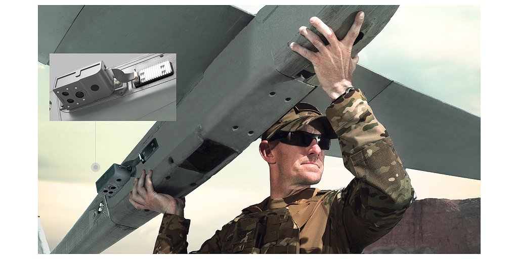
- 23-pound drone: The Puma LE drone weighs 23 pounds and is being upgraded with a Visual Navigation System (VNS) for GPS-denied environments.
Experts agree that AeroVironment's VNS upgrade is a critical adaptation for modern warfare, addressing the growing vulnerability of GPS-reliant systems in electronic warfare environments.
AeroVironment's New Drone Kit: Flying Blind to Win the EW War
ARLINGTON, VA – December 04, 2025 – AeroVironment, a titan in the defense systems market, has announced a seemingly incremental but strategically profound upgrade to its workhorse Puma drone fleet. The integration of its Visual Navigation System (VNS) with the Puma Long Endurance (LE) model completes a capability rollout across the entire Puma family, enabling these small unmanned aircraft systems (SUAS) to navigate with precision in environments where GPS signals are jammed, spoofed, or entirely absent. While the announcement of an add-on kit may appear routine, it represents a direct and necessary countermeasure to one of the most disruptive forces on the modern battlefield: electronic warfare.
This move is not merely a product enhancement; it is a critical adaptation for survival and operational relevance. As conflicts from Eastern Europe to the Middle East have starkly demonstrated, reliance on the Global Navigation Satellite System (GNSS) is a significant vulnerability. By equipping its widely deployed drones to operate effectively without it, AeroVironment (NASDAQ: AVAV) is solidifying its market position and providing warfighters with a much-needed tool to reclaim the tactical edge.
The Electronic Battlefield's New Rules
The strategic imperative for GNSS-denied navigation is no longer theoretical. The war in Ukraine has become a live-fire laboratory for electronic warfare (EW), where the skies are a contested electromagnetic spectrum. Reports from the front lines have been sobering, with Ukrainian forces at times losing as many as 10,000 drones per month, largely due to sophisticated Russian jamming systems like the R-330 Zhitel. These systems can create vast bubbles of electronic interference, rendering GPS-reliant drones and even precision-guided munitions dangerously inaccurate or completely ineffective.
This threat is pervasive. GNSS signals, transmitted from satellites over thousands of miles, are inherently weak and susceptible to being overpowered by ground-based jammers. More insidiously, spoofing attacks can feed false location data to a receiver, causing a drone to drift off-course or misidentify targets. The impact is catastrophic, leading to mission failure, loss of critical intelligence assets, and a breakdown in command and control. In some contested zones, the accuracy of guided munitions has been observed to drop below 10% during periods of intense GPS interference.
The problem extends far beyond a single conflict. NATO has reported thousands of interference events across Europe, particularly in the Baltic region and Eastern Mediterranean. For military planners, satellite dependence has shifted from a force multiplier to a potential single point of failure. This reality is forcing a doctrinal shift towards resilience, creating urgent demand for technologies that can provide what the industry calls "assured navigation."
Beyond GPS: How Visual Navigation Works
AeroVironment’s VNS kit is a direct answer to this demand. The system allows the Puma to effectively “see” its way across the terrain. It uses a technology known as Visual Inertial Odometry (VIO), which fuses data streams from two distinct sources in real time. A suite of downward-facing cameras constantly captures imagery of the ground, while an onboard Inertial Measurement Unit (IMU) tracks the aircraft's motion through its accelerometers and gyroscopes.
Sophisticated onboard processors then analyze the visual data to identify and track features on the ground, calculating the drone's movement relative to those features. By combining this visual motion tracking with the inertial data, the system can calculate a highly accurate estimate of its position, velocity, and orientation without needing an external GPS signal. According to the company, the VNS automatically transitions between GNSS-enabled and GNSS-denied modes with zero pilot input, ensuring mission continuity is seamless.
“Assured navigation is critical to the mission, especially as GNSS becomes an increasingly vulnerable resource,” said Jason Hendrix, Vice President of Small Uncrewed Systems for AeroVironment. “By fusing visual and inertial data in real time, the system enables uninterrupted flight paths, accurate geolocation, and mission continuity in unreliable GNSS regions.”
However, VIO technology is not without its own operational constraints. Its performance is contingent on the environment. In conditions with poor visibility such as heavy fog, dust, or nighttime without sufficient ambient light, the system's cameras may struggle. Similarly, flying over textureless terrain—like vast stretches of calm water, fresh snow, or desert sand—can deprive the algorithm of the distinct visual features it needs to track motion, potentially leading to drift or inaccuracy. Despite these limitations, for the majority of operational scenarios, VIO provides a robust and indispensable backup to GPS.
A Strategic Upgrade in a Crowded Field
AeroVironment is not alone in the race to solve the GPS-denied puzzle. The defense and technology sectors are rich with innovation in this area. Competitors like Skydio are leveraging advanced AI and computer vision for autonomous navigation, while established defense contractors like Honeywell offer their own resilient navigation solutions pairing inertial systems with other sensors. Other specialists are demonstrating capabilities that use terrain fingerprinting or advanced sensor fusion to achieve similar results.
What makes AeroVironment's move particularly strategic is its implementation. The VNS is not just for new drones; it is being offered as a simple, two-piece retrofit kit for the vast fleet of Puma 2 AE, 3 AE, and LE systems already fielded by the U.S. military and its allies. This creates a direct and cost-effective upgrade path for existing customers, fostering loyalty and immediately enhancing the capability of thousands of deployed assets. It transforms a potential platform-wide vulnerability into a new layer of resilience across an established product line.
This upgrade is part of a broader strategy to evolve the Puma LE from a pure intelligence, surveillance, and reconnaissance (ISR) platform into a more versatile and lethal tool. Recent enhancements, including the integration of a Laser Target Designator and a Universal Gimbal Kit, are turning the 23-pound drone into a precision-engagement system capable of not just finding targets, but guiding munitions to them.
“Every upgrade to Puma LE, including the addition of the VNS kit and our new laser designator and gimbal capabilities, is driven by one goal: giving the warfighter greater confidence, flexibility, and capability,” noted Trace Stevenson, President of Autonomous Systems at AeroVironment. This continuous, modular evolution ensures the Puma platform remains at the forefront of technology, adapting to threats faster than procurement cycles for entirely new systems would allow.
This approach of incremental, yet powerful, upgrades strengthens the company's competitive moat. By addressing the most pressing operational challenges with practical, field-ready solutions, AeroVironment is not just selling a product; it is selling mission assurance. In a market where reliability under fire is the ultimate currency, this focus on battlefield resilience is a powerful differentiator that secures its position as a key partner for modern military forces navigating the complexities of 21st-century conflict.